How to Make Your Own Montessori Pin Map
**This post contains affiliate links**
The Montessori pin maps are one of my favorite geography materials in an elementary classroom. This material is a wonderful way to engage children in learning world geography. Using an atlas for accuracy, children place pin labels on maps to name countries, major cities, capitals, and major waterways. It is a time-consuming activity. Upon completion, children often feel proud of themselves and the work they have done.
Unfortunately, the cost of adding this material to a homeschooling environment is typically too much. The complete set is around $1,000. For our family, this was certainly unaffordable. After some thought, and browsing the internet for alternatives, I decided to try a Do-It-Yourself project. The cost was quite low, and my older daughter became very interested in the process, which was a bonus!

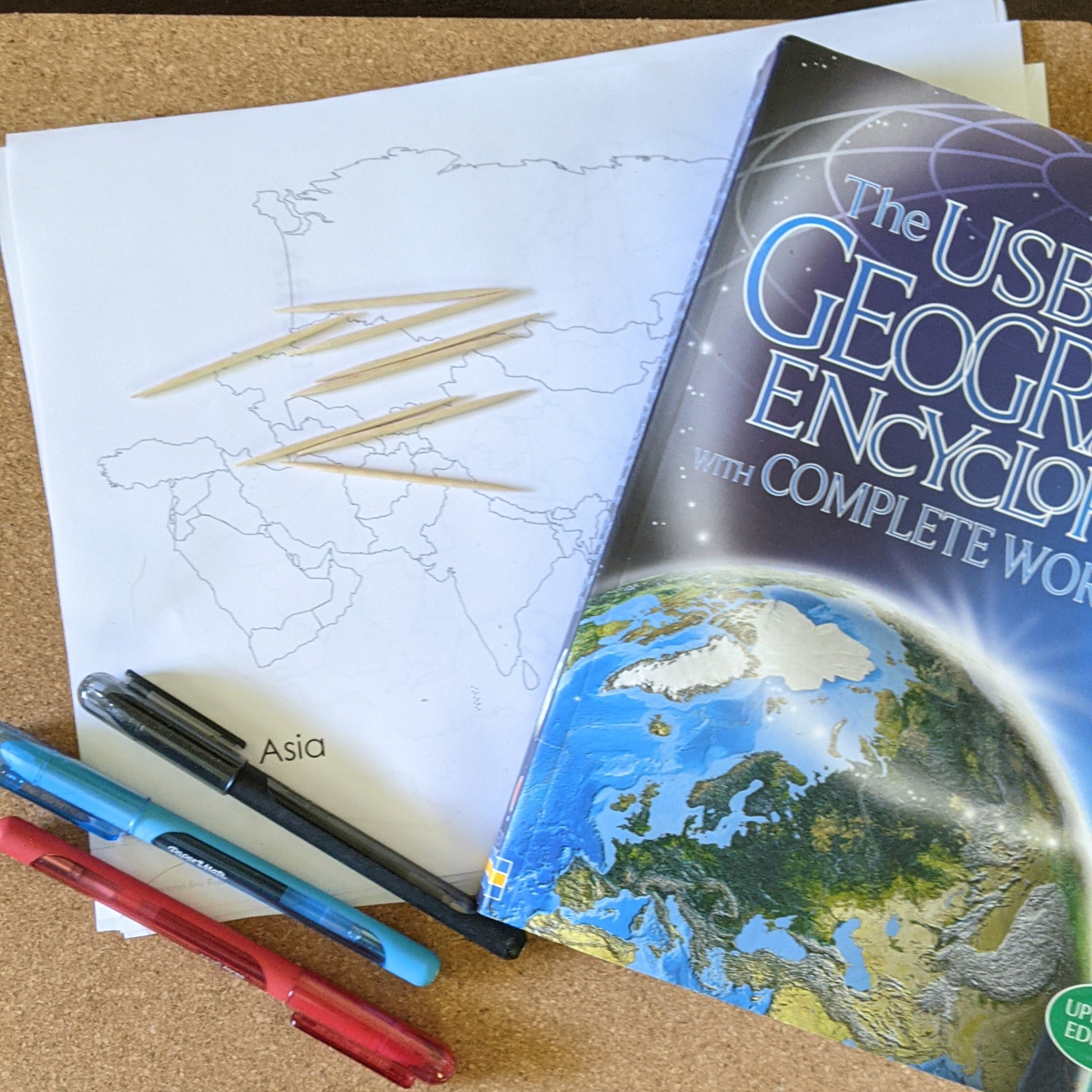
Materials Needed
It took me a long time to settle on the specific materials I would use and how I wanted the map boards to look. Here is what I finally decided on:
- Cork Boards
- Unlabeled maps of each continent – There are many free options
- Toothpicks
- Map Labels – I created them and currently have European labels available in my TpT store.
- Colored pens or permanent markers
- Atlas (or online maps). We used the Usborne Geography Encyclopedia. The DK Smithsonian Children’s Illustrated Atlas is another great option. I highly recommend purchasing an atlas for homeschool use, as it is a quick and easy resource. I have found children browsing the atlas for pleasure many times and sometimes even learn things they would not have from a simple web search.
Lots of Dots
Since my daughter is interested in studying Europe next, I decided to start with a pin map of Europe first. I opened the atlas to a political map of Europe and got out my printed map. First, I made large red dots approximately where each capital city is located. Since we are using toothpicks for our “pins,” I made sure each dot was larger than a toothpick in diameter. I chose red dots, as many maps use red dots and stars to designate cities.
Next, I made large black dots for placing the name of the countries. I chose to do this after the capitals to make sure I did not place a black dot where a red dot should have been. Once that was completed, I made blue dots on the major bodies of water. If you have a map that lines major rivers, that would be great! I did not have one on hand so I stuck to seas in and around Europe.

Creating the Board
Once I got all those dots filled in (and double-checked to make sure I didn’t miss any!), I glued the paper to one of the cork boards. I placed the paper toward the bottom, so there were a few inches above the map. This way, my kids could place the toothpicks in the cork to be ready before they need them, making it easier to find each name.
While The cork board was set to the side to dry, I printed and cut labels. To help the children sort the different flags, I put a black, red, or blue dot on each flag, front and back. I wrote the name of the country, capital, or water body on the front. On the back, I have a small color image of the continent (e.g. a red image of Europe) and the word country, capital, or water body. I folded in half and glued them onto toothpicks.

After the map was completely dry, I used a toothpick to pock holes in each of the dots on the map. Ideally, each dot was larger than the toothpick, so the color is still visible with the hole. I had to make a couple dots larger, which I felt was important because I wanted the children to be able to match the colored dots on the label to the one on the map.
I keep the pins in a small food storage container when the map is not in use. The pin maps are stored on a shelf, stacked neatly. I may label the front of each map to make it easier to find the one they want, but I have not done that yet.
This was a time-consuming project- probably over an hour for one map, but it was worth it to us. I enjoyed working on it and I liked the involvement of my children. I hope you found this helpful and maybe even inspirational – even if the inspiration was to buy them already made!